The Evolution of Waterford’s West Side
The first immigrants in the late 1830s were from the northeastern part of the United States which were predominantly English speaking. As word spread about the territorial development westward, a large number of German and Irish settlers came to call this area home. It was very common in the pioneer days for ethnic groups to stick together for their common communication and support. As the settlement developed, Germans were predominantly located west of the Fox River while the Irish tended to locate on the eastern side.
At the center of the village would be the primary reason for its existence – water power. The area along the river from the dam to Main Street became the “industrial park” of its time. Over time, a sawmill and two grist mills grew to add, a creamery, fanning mill, paper mill, distillery, and other businesses all crowded together to share the water resource. A “runaway” water trench fed several businesses along its return back to the river just north of the bridge. More information can be found at the MILLS OF WATERFORD page. Being an agrarian society for the most part, support businesses soon followed. A general mercantile store, blacksmith shop, clothing store, and an inn were amongst the earliest.
The May, 1844 edition of the Racine Advocate states that “Waterford had 150 inhabitants, two sawmills, two grocery stores, one public house, and business enough for another”.
Churches were central to the pioneers both for common community and religious services in their shared language. It was common to share places of worship but not the services. The first religious services were held in the Chapman log cabin home and were conducted by Levi Barnes, Chapman’s father-in-law, who was a preacher in the Congregational church. The Germans began immigrating here in 1852 and started the Methodist church but shared the Congregational facilities.1 All but the Catholic Church were located on the west side.
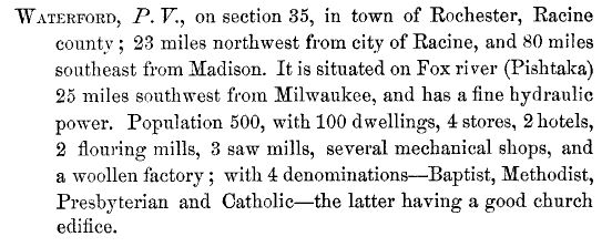
1853 Wisconsin Gazetteer Entry2

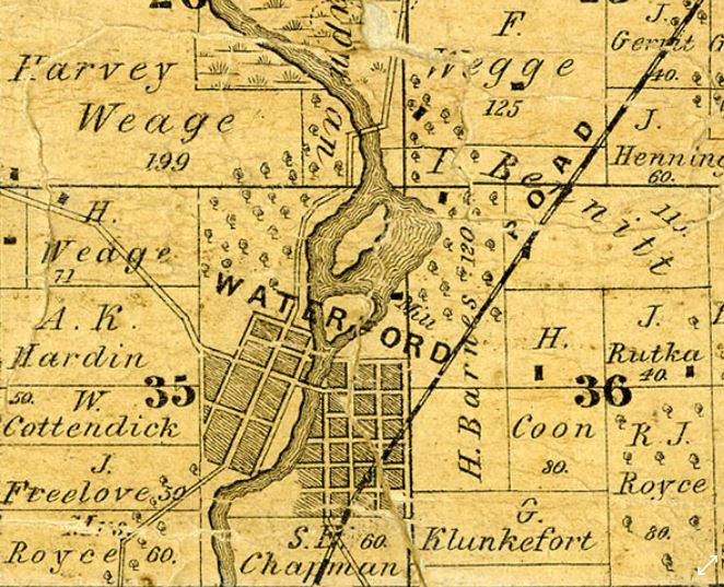
1858 Map of Waterford with Business Directory.
Certain skills were basic to the community and it would be usual business practice to favor certain ethnic groups. As shown on the 1858 map, the west side developed earlier with most businesses concentrated there.
1850 Plank Roads3
A major factor in the development of the west side was that it was along the Waterford Plank Road – a 12-mile branch that opened in 1849, that ran from Burlington to the Muskego toll road junction of the Milwaukee-Janesville Plank Road. The main plank road was used to transfer minerals from southwest Wisconsin and farm products from other areas to the port of Milwaukee. Roads were made out of two-inch thick by eight-foot-long white oak planks laid side-by-side, forming a hard surface on which to travel. Its route went through Rochester, along Jefferson Street, continuing on about a half mile north of the dam where it crossed the river and headed through Wind Lake and on to Muskego.4,5,6
1858 Township Map. Racine County Historical Museum.
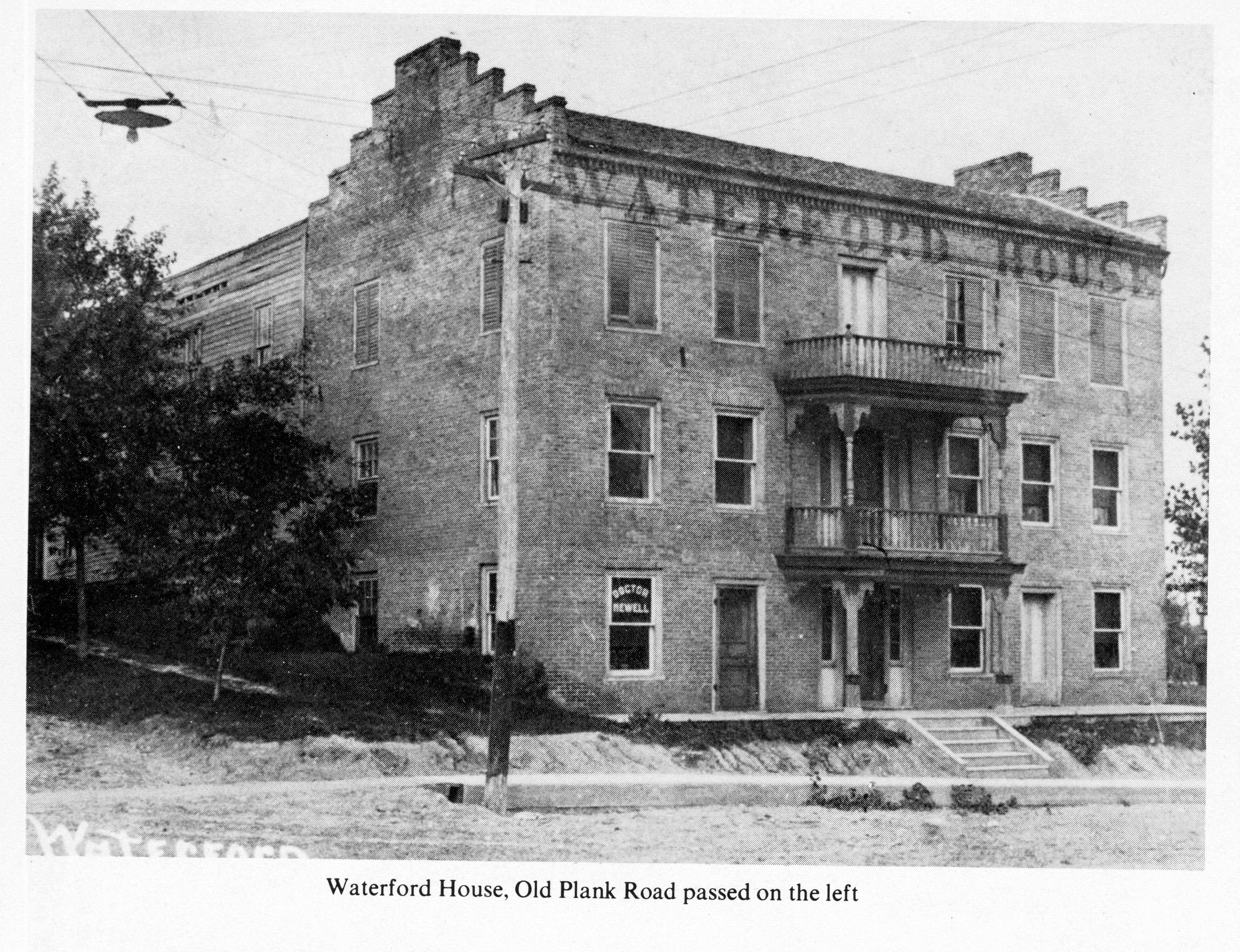 Early settler Sam Russ and his wife, Adeline, started in business with a small traveler’s rest stop about half way up the hill on the east side of North Jefferson Street, with a few rooms and fine quality food. Russ’ hospitality business grew quickly which led him to erect a large, red brick hotel just to the south which was on the northeast corner of Main and Jefferson streets. Russ’ brother-in-law, Samuel Chapman, lived on the southwest corner.
Plank roads started to disintegrate after about five years of use. (there were no wood preservatives in the day). It is assumed by the author that maintenance and convenience would have caused the road to relocate through Waterford’s Main Street and link up with Milwaukee Road four blocks east of the river – which linked up to the Waterford Plank Road. By the late 1850s, railroads were replacing the plank roads throughout the state with a more efficient and cost-effective way to move people and goods. However, no railroad service was brought to Waterford until June 18, 1909.7This meant that the roads had to be maintained and upgraded to continue to move people and goods.
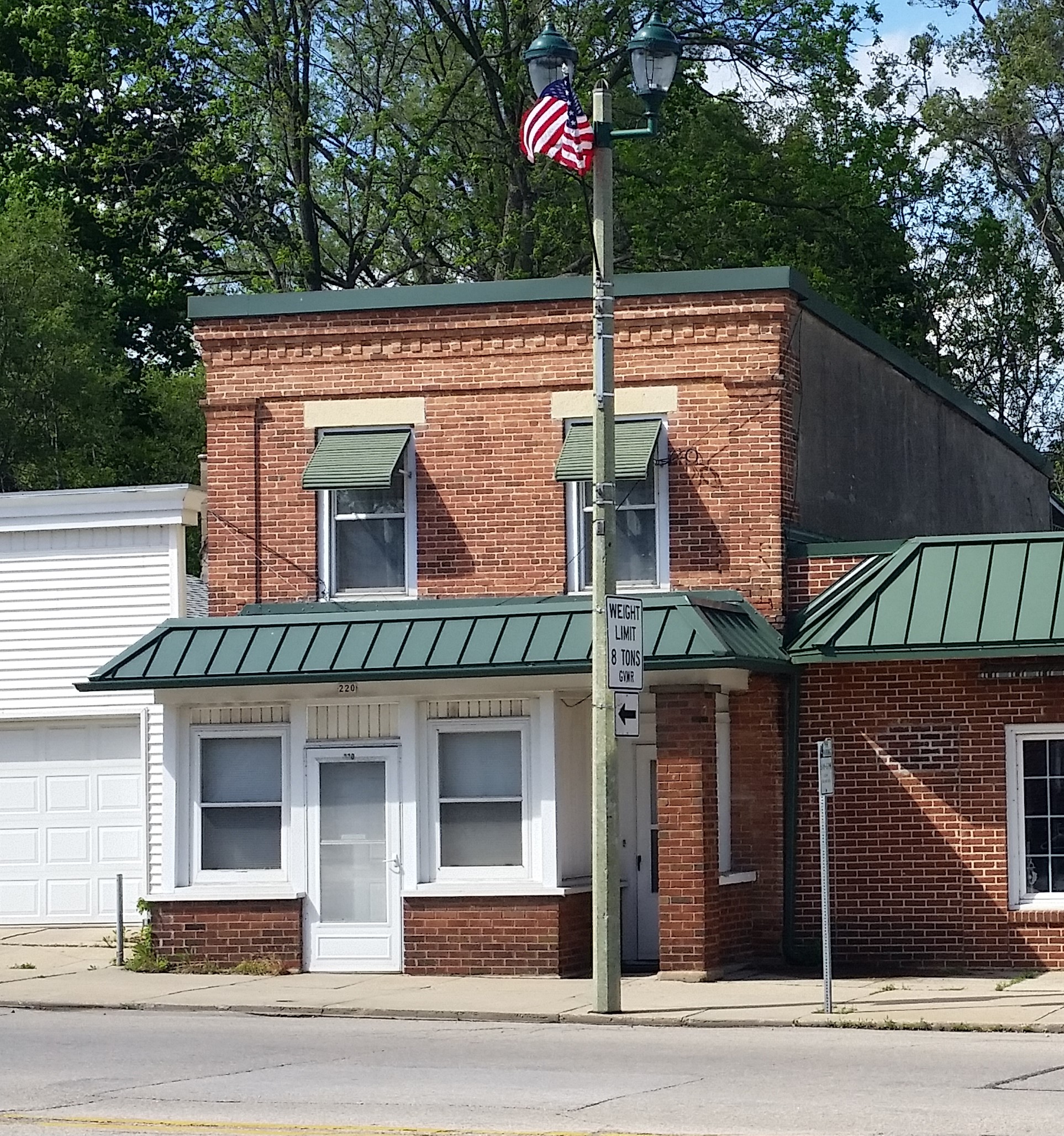
Geo. McLeish Bldg. Today – Built c. 1845.
The oldest buildings still standing, as shown on the 1858 map, are George McLeish’s Clothing and Tailor Shop (now apartments) ca. 1845 and the F.A. Weage building (Enve’ Salon and Day Spa) ca. 1851.
The evolution of the west side was slow with the gradual replacement of the old wooden or stone structures giving way to more modern business development. Some buildings suffered loss from fires. Others just deteriorated from the elements and lack of maintenance. While renovations have been made, we are fortunate to have had a few people preserving our heritage and the exteriors are continuing to be maintained.
For further information, see web pages EARLY HISTORY and EAST SIDE.
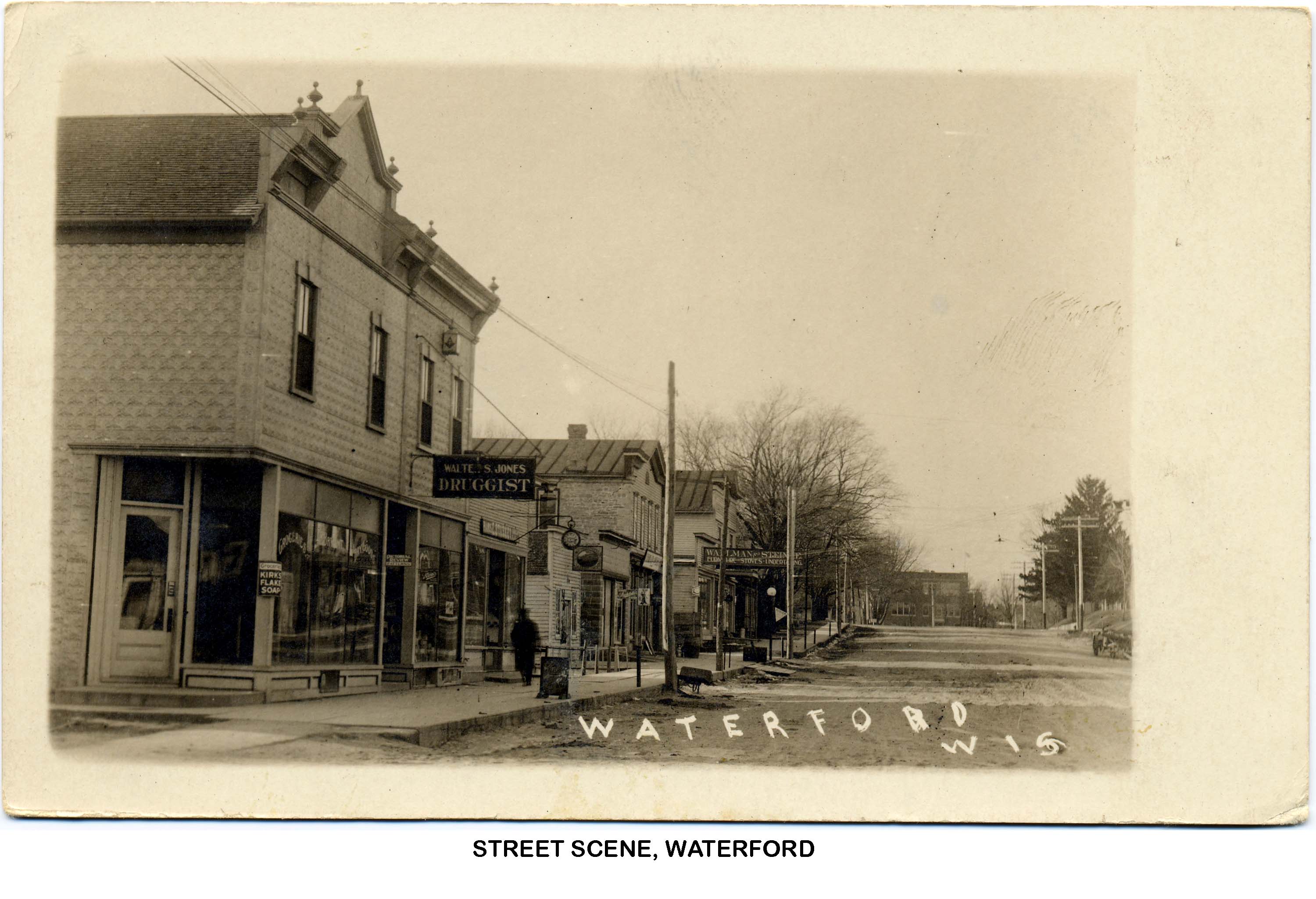
The following slide show represents the collection of street scenes dating back from early photography to the present. All of the pictures are courtesy of the Waterford Public Library, the Wisconsin Historical Society, or the University of Wisconsin digital collection.8
Lead Researcher: Robert E. Gariepy, Sr.
NOTE: Should the reader have further documentation to enhance the content of this web page, please contact the Lead Researcher email at: waterfordwiheritage@gmail.com. We are particularly interested in pictures or historic artifacts that may be shared. Credit will be given.
Sources:
- A Brief history of Our Waterford Area Churches by Ruth Albee – 1923, Wisconsin Historical Society Archives, Madison, Wis.
- Hunt, John Warren, Wisconsin Gazetteer, 1853, Wisconsin Historical Society, Google digitization: https://archive.org/details/wisconsingazett01huntgoog/page/n8/mode/2up
- http://www.watertownhistory.org/Articles/WatertownPlankRoad.html
- https://books.google.com/books?id=Qio0AQAAMAAJ&hl=en
- https://www.hmdb.org/m.asp?m=101975
- Damaske, Charles, Along the right-of-way to Burlington, 1994: http://digital.library.wisc.edu/1711.dl/WI.WPLBurling..
- Ibid.
- Wisconsin Digital Collections: http://digital.library.wisc.edu/1711.dl/WI.WaterfordLocHist

This was a amazing article! I learned so much from it!
LikeLike
Very interesting. I live in Liverpool UK as my Irish ancestors got stuck here unfortunately. I saw the name of your town was Irish inspired and found your history very touching. I’m sure the lives of those bold enough to come out west in those old days was eventually way better than the horrors they left behind. Good look with preserving your history.
LikeLike